Supporting Volcano Monitoring From Radar and Optical Satellite Imagery

Satellite remote sensing has become an essential tool for monitoring volcanic activity and responding to crises in near real time. Recent developments in imaging techniques, combined with an increasing number of space missions – operated by public agencies or commercial companies – today provide a wealth of satellite images. During the course of an eruption, the synergy between high-resolution radar (SAR) and optical imagery enables a rapid assessment of volcanic deformation and topographic changes (including lava flows, ash deposition, or lava dome growth/destruction). These data bring invaluable information on eruption dynamics, and contribute to improving volcanic hazard assessment.
Interactive tools for Volcano Observatories
Delivering satellite observations to end-users, especially scientific teams working in volcano observatories, is a long-term goal that the "Volcano Space Observatory" (VSO) pilot is aiming to address. Interactive interfaces have been developed in the VSO to reconstruct gas and particle emissions and track the evolution of volcanic plumes. New developments will include the upcoming "Volcano Ground Deformation" platform using Sentinel-1 InSAR.
Emergency acquisitions by high-resolution imaging satellites
Upon alert by volcano monitoring agencies, Pléiades satellites can be tasked in emergency mode to acquire optical imagery through the FormaTerre – CNES "CIEST2" protocol. These data are automatically ingested into FormaTerre's processing service DSM-Opt, allowing for a rapid assessment of topographic changes.
In parallel, high-resolution SAR images delivered by Capella Space bring complementary coverage at high spatial and temporalresolutions. SAR sensors have the ability to see through clouds or volcanic plumes, a key asset for providing visually-interpretable images of rapidly-changing volcanic landforms, such as explosive craters, fissures or ash/lava deposits. A detailed discussion on these collaborations, highlighting the real-time potential of high-resolution SAR imaging for volcano surveillance, is available in the blog post by Raphaël Grandin:
Remote Sensing Brings Volcano Monitoring Toward Real-Time Capability.
Case Studies
The cases presented here demonstrate how these recent advances contribute to scientific research, hazard assessment, and disaster response.
Nyiragongo Volcano, Democratic Republic of the Congo (2021 Eruption)
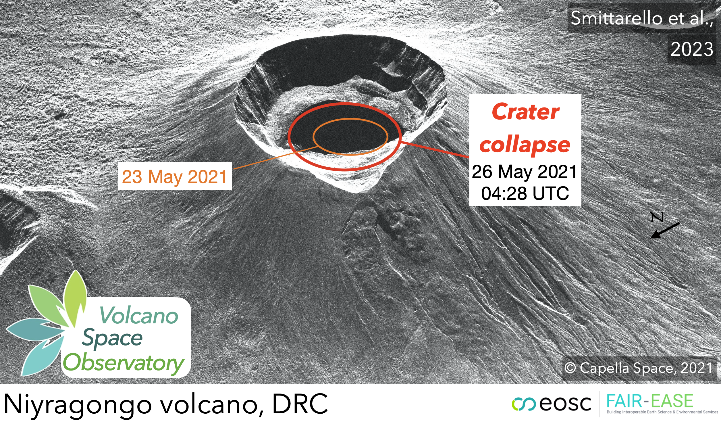
- This study showcases the contribution of satellite-based SAR imagery to understanding the progressive crater collapse associated with the drainage of the Nyiragongo lava lake, feeding lava flows that propagated toward populated areas.
Reference: Smitarello, Grandin & al. (2023) – Journal of Geophysical Research (Solid Earth).
Piton de la Fournaise, La Réunion
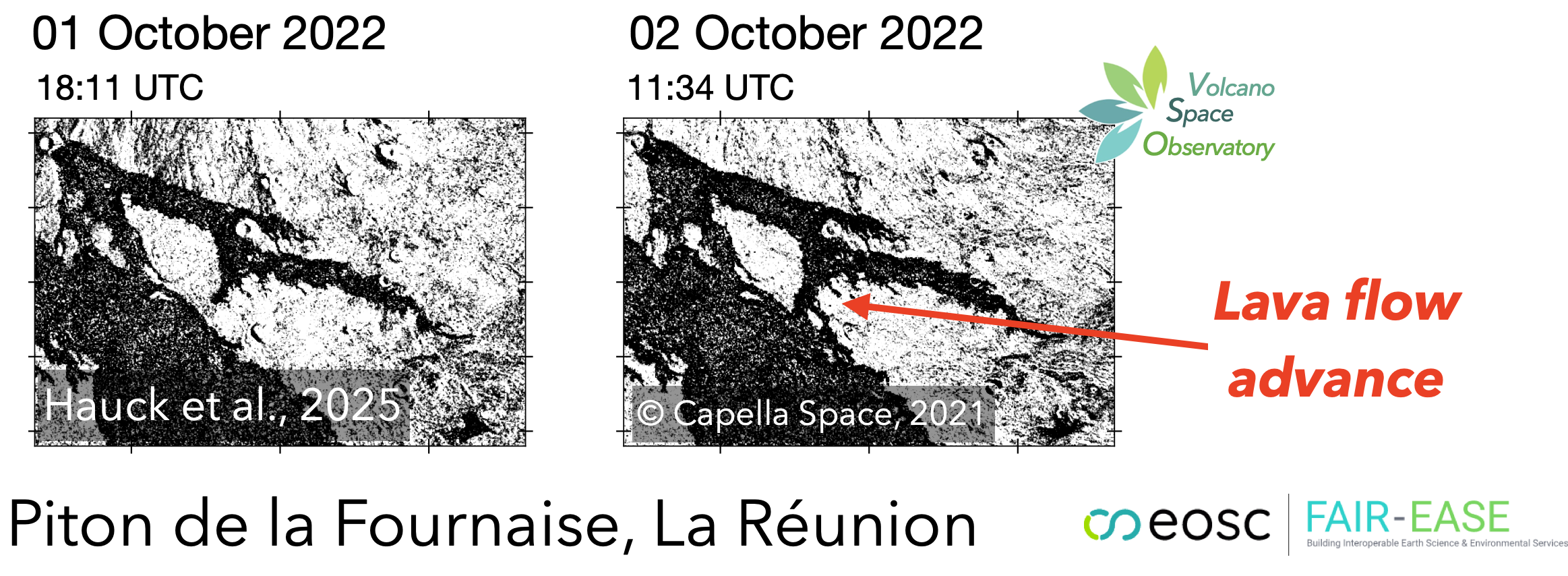
- Monitoring lava flows at Piton de la Fournaise, one of the world's most active volcanoes, using SAR and optical data.
Reference: Chevrel, Villeneuve, Grandin & al. (2023) – Volcanica. - Towards near real-time monitoring of volcanic deformation and lava flow eruption using Capella Space SAR images: application to Piton de la Fournaise.
Reference: Hauck, Grandin et al. (2025) – In preparation
Soufrière St. Vincent Eruption (2021)
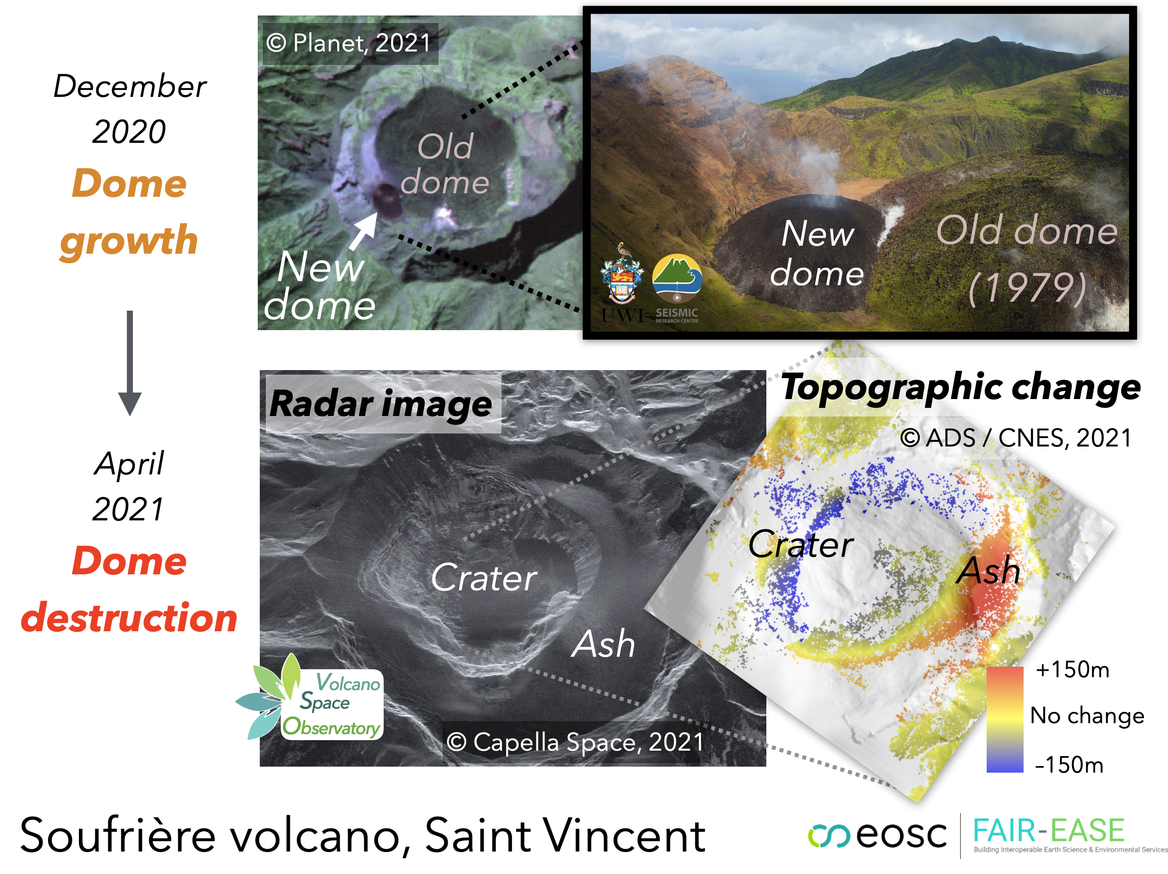
- Multi-sensor monitoring of the Soufrière St. Vincent eruption allowed for capturing the destruction of a lava dome on 9 April 2021, mapping topographic changes, tracking the eruption dynamics and assessing the extent of pyroclastic flow deposits.
References:
- Boichu & Grandin (2021) – HAL Archive
- Dualeh et al. (2023) – ScienceDirect
- Gueugneau et al. (2024) – Lyell Collection
- Grandin et al (2021) – CIEST2 report
Cumbre Vieja (La Palma) Eruption (2021)
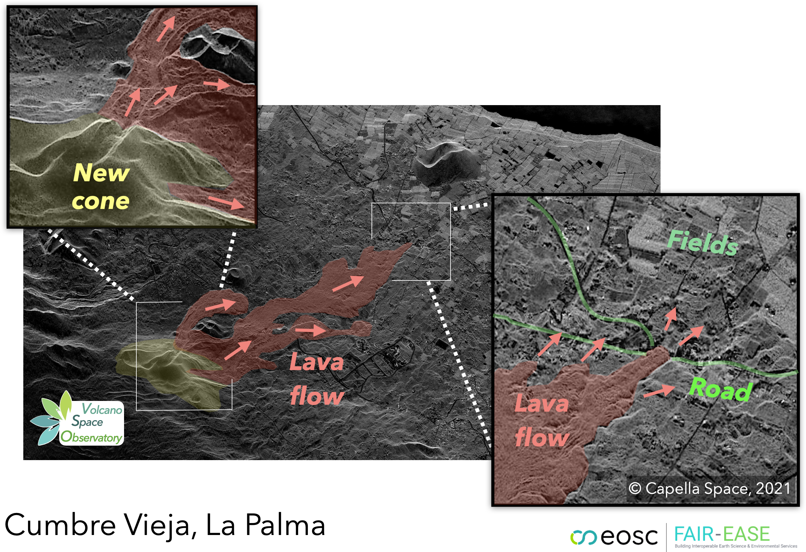
- This study highlights how the synergy between high-resolution SAR (Capella) and optical (Pléiades) imagery allows for mapping lava flows and ash deposition, as well as monitoring the formation of new cones.
Reference:
- Pôle Terre Solide – Monitoring Cumbre Vieja Eruption
- Ezquerro et al. (2023) – ScienceDirect.